

About Zoom Earth - Weather Forecast
Learn more about this application's features and capabilities.
Zoom Earth is a comprehensive weather visualization platform designed for users who need real-time satellite imagery and precise storm tracking. This software solves the problem of relying on static, delayed weather reports by providing a live view of global weather patterns. It is an essential tool for travelers, outdoor enthusiasts, and professionals who require high-resolution data to monitor hurricanes, wildfires, and changing atmospheric conditions.
Key Features of Zoom Earth
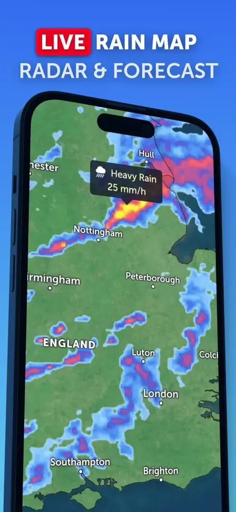
- Live Satellite Imagery: Access near real-time views of the planet with frequent updates every 10 to 15 minutes.
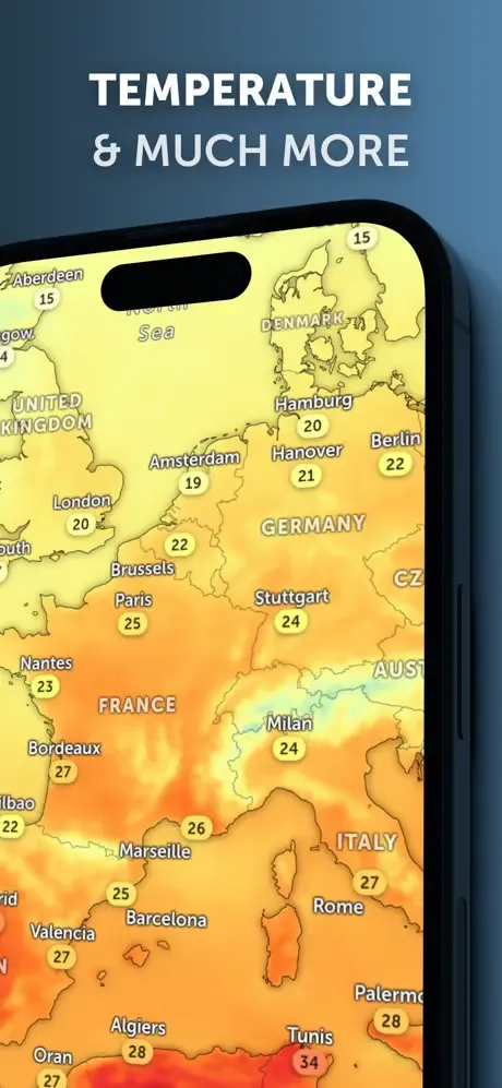
- Interactive Weather Maps: Visualize wind speed, temperature, pressure, and humidity layers through an intuitive interface.
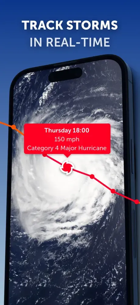
- Tropical Cyclone Tracking: Monitor the current paths and future forecasts of hurricanes, typhoons, and tropical storms.
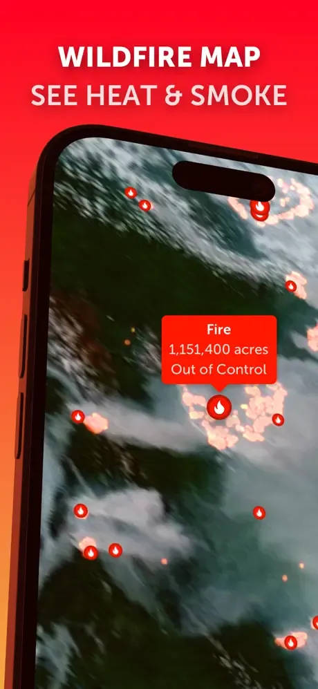
- Wildfire Monitoring: View active fire hotspots and smoke plumes using satellite-based thermal imaging.
- Historical Data: Browse past satellite images to observe how weather events and landscapes have evolved over time.
Use Cases
- Emergency Preparedness: Residents in coastal areas can track the progression of severe storms to make informed safety decisions.
- Flight Planning: Pilots and drone operators can check cloud cover and wind patterns to ensure safe flying conditions.
- Environmental Research: Educators and researchers can observe the movement of smoke from wildfires or the impact of major floods.
- Outdoor Event Management: Organizers can monitor localized rain radar to manage schedules for concerts or sporting events.
Why Choose Zoom Earth
This tool stands out for its emphasis on visual clarity and real-time data integration. By merging satellite photography with advanced forecasting models, the platform offers a more transparent and immediate understanding of the weather compared to traditional text-based apps.
Pros and Cons
Pros
- High-resolution global satellite coverage.
- Minimalistic and fluid map navigation.
- No account registration required for basic tracking.
Cons
- Requires a stable high-speed internet connection for smooth zooming.
- Some advanced satellite layers may have a slight processing delay.
Final Verdict
Zoom Earth is a powerful and visually stunning software for anyone needing more than just a basic temperature reading. It provides a professional-grade window into global weather events, making it a top-tier choice for real-time environmental monitoring.
Ratings & Reviews
Please log in to write a review.
No reviews yet. Be the first to rate!