
About GPS Map Camera
Learn more about this application's features and capabilities.
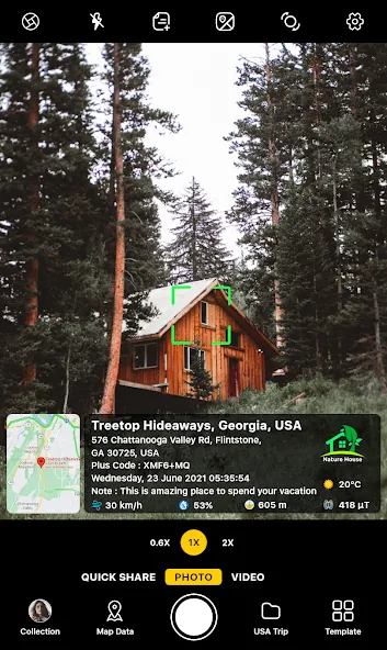
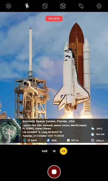
GPS Map Camera is a specialized photography tool designed to embed precise geographic data directly onto your images and videos. By integrating real-time GPS coordinates, addresses, and timestamps, this software solves the problem of undocumented site visits and forgotten travel locations. It is an essential platform for professionals in field research, construction, and real estate, as well as travelers who want to preserve the exact context of their memories.
Key Features
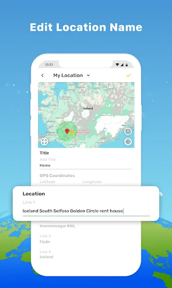
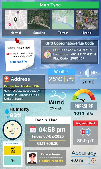
- Automatic Geotagging: Instantly adds latitude, longitude, and physical addresses to every photo you capture.
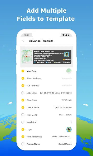
- Customizable Templates: Choose between classic or advanced layouts to display map data, weather, and compass directions.
- Real-Time Overlays: View live maps and coordinates on the camera interface before snapping a shot.
- Metadata Integration: Stamps date, time, and custom notes directly onto the media for easy filing and verification.
- Digital Compass and Sensors: Includes built-in tools to measure altitude, magnetic fields, and wind speed.
Use Cases
- Construction Management: Document project progress with verified location stamps to ensure accountability and reporting accuracy.
- Real Estate Listings: Provide potential buyers with authentic, location-verified photos of properties and surrounding areas.
- Field Inspections: Capture evidence of site conditions for insurance claims or architectural surveys with uneditable geodata.
- Travel Journaling: Keep a chronological and geographical record of your journeys by tagging landmarks and scenic stops.
Why Choose GPS Map Camera
This tool offers a seamless way to transform standard photos into verifiable documents. Unlike basic camera apps, it provides a specialized environment for capturing high-accuracy metadata, making it a reliable benefit for anyone needing technical proof of presence. The software streamlines the documentation process, reducing the need for manual record-keeping.
Pros and Cons
Pros
- High accuracy for GPS coordinates and address details.
- Extensive customization for stamp visibility and formatting.
- Supports both photo and video geotagging.
Cons
- Increased battery consumption due to continuous GPS usage.
- The interface may contain advertisements in the free version.
Final Verdict
GPS Map Camera is a robust and practical solution for combining photography with precise location tracking. It is a must-have tool for professionals and explorers who require credible, time-stamped visual evidence.
Ratings & Reviews
Please log in to write a review.
No reviews yet. Be the first to rate!