
About Paris Metro – Map and Routes
Learn more about this application's features and capabilities.
The Paris Metro Map and Route Planner is a dedicated navigation tool designed for travelers and commuters navigating the extensive RATP transit network in Paris. This software simplifies urban travel by providing offline access to official maps and an intelligent routing engine. It addresses the common problem of losing connectivity in underground tunnels, ensuring users can find the best path between stations like Gare du Nord or Charles de Gaulle Airport without relying on a stable data connection.
Key Features
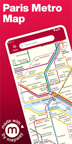
- Official RATP Map: High-resolution interactive map featuring the Metro, RER, and Tramway lines.
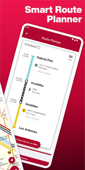
- Offline Route Planner: Calculates the fastest routes between any two points without requiring an internet connection.
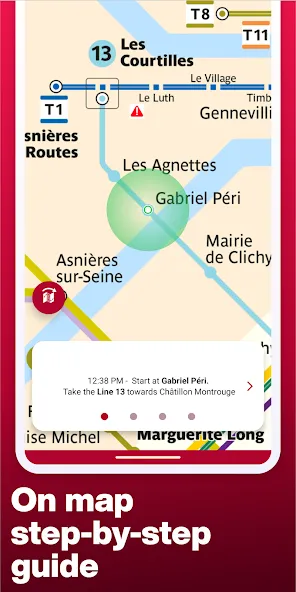
- Step-by-Step Directions: Provides clear instructions on where to change lines and estimated travel times.
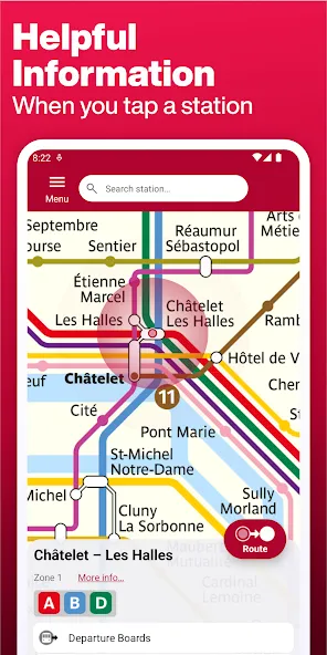
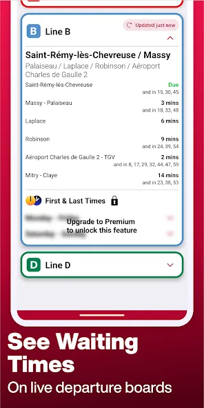
- Live Status Updates: Delivers real-time information on delays, maintenance, and service disruptions when online.
- Uber Integration: Built-in functionality to request a car for the final leg of a journey if walking is not preferred.
Use Cases
- Tourist Navigation: Helping first-time visitors find their way to iconic landmarks like the Eiffel Tower or the Louvre efficiently.
- Daily Commuting: Assisting local residents in finding alternative routes during peak hour congestion or line closures.
- Airport Transfers: Planning precise timings for trips between central Paris and CDG or Orly airports.
- Offline Wayfinding: Navigating the deep underground sections of the Metro where mobile signals are frequently unavailable.
Why Choose Paris Metro Map and Route Planner
This platform prioritizes reliability and ease of use. Unlike generic map apps, it focuses specifically on the nuances of the Paris transit system, offering a lightweight interface that doesn't drain battery life while providing essential transit data.
Pros and Cons
Pros
- Fast and responsive offline search engine.
- Clean, ad-supported interface that is easy to read on the move.
- Accurate estimates for travel duration and station transfers.
Cons
- Requires a subscription for full ad removal and VIP features.
- Real-time data is only accessible with an active data connection.
Final Verdict
The Paris Metro Map and Route Planner is an essential utility for anyone looking to master the Parisian transit system. It balances robust offline functionality with helpful live updates, making it a dependable companion for both short trips and long-term stays.
Ratings & Reviews
Please log in to write a review.
No reviews yet. Be the first to rate!