

About GPS Maps Camera
Learn more about this application's features and capabilities.
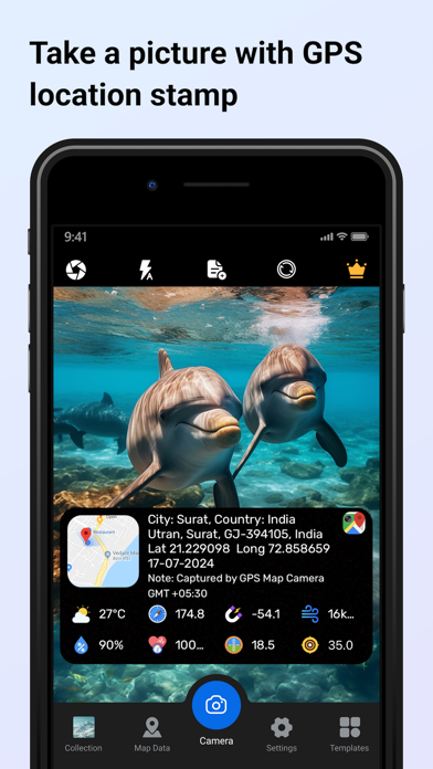
GPS Maps Camera is a specialized photography tool designed for professionals and hobbyists who need to document precise location data within their images. By embedding real-time geographic coordinates, timestamps, and map overlays directly onto photos, the software solves the problem of manual logging and verification for field work. It is an ideal platform for surveyors, geologists, and travelers who require verifiable visual evidence of their activities.
Key Features
- Automatic Geotagging: Automatically embeds latitude, longitude, and altitude data into every photo captured.
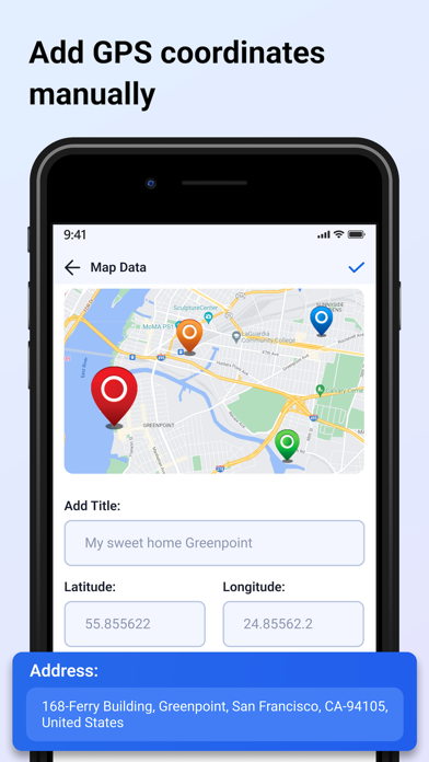
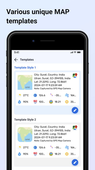
- Customizable Overlays: Add date, time, and specific address stamps in various formats to suit professional requirements.
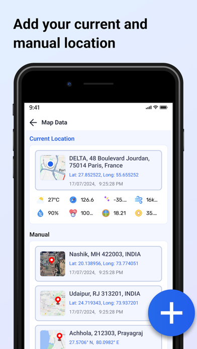
- Integrated Map View: Displays a mini-map on the camera interface to provide spatial context during the shoot.
- Project Organization: Groups images by location or date, making it easier to manage large sets of field data.
- High-Resolution Support: Maintains original image quality while applying essential data metadata.
Use Cases
- Construction Monitoring: Document site progress with exact time and location stamps for stakeholder reporting.
- Real Estate Inspections: Capture property details with embedded addresses to streamline appraisal workflows.
- Scientific Fieldwork: Log geological or biological sightings with precise coordinates for accurate data mapping.
- Travel Documentation: Maintain a chronological and geographical record of trips for personal archives.
Why Choose GPS Maps Camera
This tool offers a seamless blend of navigation and photography, ensuring that every image serves as a data-rich document. The benefits of using this software include increased accountability and reduced administrative time, as all necessary location details are baked into the file at the moment of capture.
Pros and Cons
Pros
- Accurate real-time GPS data synchronization.
- Flexible stamp templates for different professional industries.
- Simple, intuitive interface for quick capturing.
Cons
- Continuous GPS usage can impact battery life during long sessions.
- Requires clear sky access for the highest coordinate precision.
Final Verdict
GPS Maps Camera is a reliable utility for anyone needing to bridge the gap between photography and geographic data. It provides a practical, automated solution for authenticating visual records with high accuracy.
Ratings & Reviews
Please log in to write a review.
No reviews yet. Be the first to rate!