

About Mappls MapmyIndia Maps
Learn more about this application's features and capabilities.
Mappls MapmyIndia Maps is a highly specialized navigation platform designed specifically to handle the unique challenges of the Indian road network. Developed by MapmyIndia, this software provides hyper-local data that goes beyond traditional GPS by solving problems like confusing flyover junctions, unnumbered house addresses, and real-time road hazards. It is built for daily commuters, long-distance travelers, and delivery professionals who require high-precision mapping that global tools often miss.
Key Features 3D Junction View: Provides clear, photo-realistic visuals of complex flyovers and intersections to prevent missed turns.
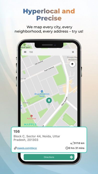
Mappls Pin: Simplifies complex addresses into a unique 6-character digital code for pinpoint doorstep accuracy.
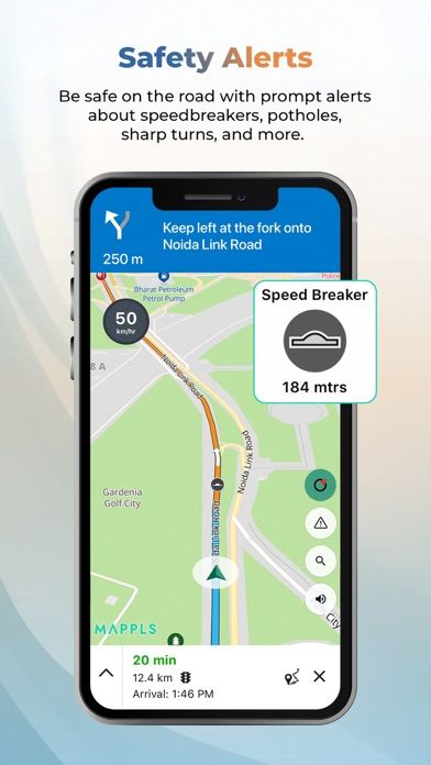
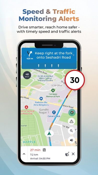
Hyper-Local Alerts: Real-time notifications for India-specific road conditions like speed breakers, potholes, and sharp curves.
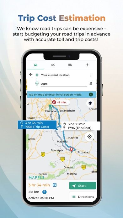
Trip Cost Estimator: Calculates estimated fuel costs and NHAI toll charges to help plan travel budgets effectively.
Live Traffic Signal Timer: Displays real-time countdown timers for traffic lights in supported cities to reduce idling and stress.
Multimodal Transit: Integrated information for metro, rail, and bus routes across major Indian metropolitan areas.
Use Cases Last-Mile Delivery: Use the digital address system to find specific house numbers in densely populated residential colonies.
Safe Night Driving: Receive proactive voice alerts for upcoming road hazards and unlit speed breakers on unfamiliar routes.
Budget Travel Planning: Compare different routes based on integrated toll and fuel cost estimates for long-distance road trips.
City Commuting: Navigate public transport by tracking metro and bus timings within the same interface used for walking directions.
Why Choose Mappls MapmyIndia Maps This platform stands out as a "Made in India" tool that prioritizes local road nuances and data sovereignty. Unlike global competitors, it offers deep integration with indigenous technologies and ISRO's satellite data, ensuring that the benefits of precision mapping reach even the most remote rural areas. It is an essential utility for those who value privacy and need a map tailored to the ground realities of Indian infrastructure.
Pros and Cons Pros
Exceptional accuracy for doorstep navigation and house numbers.
Tailored safety alerts for local hazards like waterlogging or potholes.
Low data consumption and high-fidelity 3D map rendering.
Cons
User-generated traffic data is occasionally less dense than global alternatives.
Real-time signal timers are currently limited to specific urban centers.
Final Verdict Mappls MapmyIndia Maps is a robust and reliable navigation software that excels where global platforms often struggle. It offers a superior localized experience, making it the preferred choice for anyone navigating the diverse and often complex roads of India.
Ratings & Reviews
Please log in to write a review.
No reviews yet. Be the first to rate!