About Mappls - Super Map App for Maps, Navigation, Tracking, Safety and more
Learn more about this application's features and capabilities.
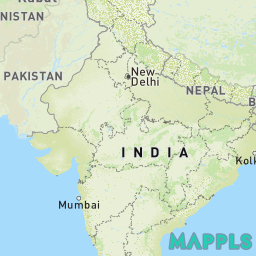
Mappls is an advanced digital mapping and navigation platform developed by MapmyIndia, tailored specifically to the unique geographical and infrastructural nuances of the Indian landscape. This website provides high-definition 4D maps, doorstep-level navigation, and hyperlocal road alerts for millions of users, businesses, and government agencies. By utilizing proprietary data collected over three decades, it solves the critical problem of navigating inconsistent address systems and unmapped rural roads that global platforms often overlook.
Key Features
- Doorstep Navigation: Provides precision guidance to the exact house number or building entrance using a high-granularity address database.
- Real-Time Safety Alerts: Delivers automated voice warnings for upcoming potholes, speed breakers, sharp curves, and accident-prone zones.
- 3D Junction View: Offers photorealistic three-dimensional previews of complex flyovers, underpasses, and interchanges to prevent navigation errors.
- Mappls Pin (Digital Address): Replaces complex traditional addresses with a simple six-character alphanumeric code for easy location sharing.
- Live Traffic Signal Timer: Integrates real-time countdown timers for traffic lights in major metropolitan areas to help drivers plan stops.
- Trip Cost Estimator: Calculates exact fuel expenses and NHAI toll fees in advance, suggesting routes that optimize both time and cost.
Use Cases
- Last-Mile Delivery: E-commerce and logistics companies use the tool to ensure drivers reach exact doorsteps in densely packed residential colonies.
- Public Safety and Governance: Government bodies utilize the platform to monitor air quality (AQI), report civic issues like waterlogging, and manage disaster response.
- Electric Vehicle Planning: EV owners leverage the website to find compatible charging stations and monitor range based on real-world terrain data.
- Rural Exploration: Individual travelers use the platform's extensive rural mapping to find government schools, clinics, and landmarks in remote villages.
Why Choose Mappls
Choosing this platform ensures access to the most authoritative and detailed mapping data available for India. Mappls stands out because it is built on sovereign infrastructure, prioritizing local data privacy and national security. The primary benefit of the platform is its "India-first" design, which accounts for specific local challenges—such as unnamed bylanes and varying road conditions—providing a level of reliability that generic global mapping tools cannot match.
Pros and Cons
Pros
- Superior accuracy in rural areas and complex urban residential addresses.
- Integrated hyperlocal safety alerts for real-world road hazards.
- Supports multiple regional Indian languages for voice-guided navigation.
Cons
- User base for real-time traffic crowdsourcing is smaller than some global competitors.
- International map coverage is less detailed compared to its comprehensive Indian data.
Final Verdict
Mappls is a definitive navigation tool for anyone residing in or traveling across India. It successfully bridges the gap between high-tech geospatial intelligence and practical, ground-level utility, making it a critical asset for modern mobility.
Ratings & Reviews
Please log in to write a review.
No reviews yet. Be the first to rate!